National Atlas & Thematic Mapping Organisation
Please turn your device
Screen Reader Access
Skip to main content
Skip to Navigation
A
+
A
A
-
Sign up
EN
हिंदी
Sign In
Register
Geoportal
राष्ट्रीय एटलस एवं थिमैटिक मानचित्रण संगठन
National Atlas & Thematic Mapping Organisation
Department of Science & Technology,Government of India
Home
Ebook Services
Atlas
Atlas of Agricultural Resources
Atlas of Rural India
Cultural Heritage Atlas Of India
Hydrological Atlas
Indian Ocean Atlas
Irrigation Atlas of India
National Atlas
First Edition
Volume 1
Volume 2
Volume 3
Volume 4
Volume 5
Volume 6
Volume 7
Volume 8
Revised Edition
Volume 1
Volume 2
Volume 3
Volume 4
Volume 5
Volume 6
Volume 7
Volume 8
Volume 9
Volume 10
Science and Technology Atlas of India
Socio Economic Atlas
State Atlas of Goa
State Atlas of Punjab
Water Resources Development Atlas
Monograph
Delhi: The City of Cities
Booklet
Domestic Violence against women in India
Kedarnath
Women Education in India
Map/Atlas Services
All
Atlas Services
Atlas of Agricultural Resources
Atlas of Rural India
Environmental Atlas
Health and Disease Atlas
Hydrological Atlas
India - Asean Archaeological Atlas
Indian Ocean Atlas
Irrigation Atlas
National Atlas
First Edition
Volume-1
Volume-2
Volume-3
Volume-4
Volume-5
Volume-6
Volume-7
Volume-8
Revised Edition
Volume-1
Volume-2
Volume-3
Volume-4
Volume-5
Volume-6
Volume-7
Volume-8
Volume-9
Volume-10
National School Atlas
Science and Technology Atlas of India
Socio-economic Atlas
State Atlas
Goa
Punjab
Maharashtra
Tourism Atlas
Water Resource Atlas
Demo
Map Services
District Planning Map Series
Andaman and Nicobar Island
Andhra Pradesh
East Godavari
Guntur
Khammam
Krishna
Mahbubnagar
Prakasam
Sri Potti Sriramulu Nellore
Vishakhapatnam
Vizianagram
Warangal
West Godavari
Arunachal Pradesh
Changlang
Dibang Valley
East Siang
Lohit
Lower Subansiri
Tirap
Upper Siang
West Siang
Assam
Barpeta
Cachar
Dibrugarh
Hailakandi
Jorhat
Kamrup
Karbi Anglong
Karimganj
Lakhimpur
Nalbari
North Cachhar Hills
Sibsagar
Tinsukia
Bihar
Bhagalpur
Darbhanga
Deoghar(Bihar)
Dhanbad(Bihar)
Katihar
Khagaria
Madhubani
Madhepura
Paschim Champaran
Rohtas
Saharsa
Samastipur
Saran
Supaul
Chandigarh
Chhattisgarh
Bastar
Bilaspur
Dantewada
Dhamtari
Durg
Janjgir Champa
Jashpur
Kanker
Kawardha
Korba
Koriya
Mahasamund
Raigarh
Raipur
Rajnandgaon
Surguja
Daman and Diu
Delhi
Goa
North and South Goa
Gujarat
Ahmedabad and Gandhinagar
Kachchh
Kheda
Panch Mahals
Sabar Kantha
The Dangs
Vadodara
Valsad
Haryana
Ambala
Gurgaon
Hisar
Karnal
Mewat
Panchkula
Panipat
Rewari
Rohtak
Sonipat
Yamunanagar
Himachal Pradesh
Kinnaur
Kullu
Lahaul & Spiti
Shimla
Sirmaur
Solan
Jammu and Kashmir
Kargil
Leh Ladakh
Jharkhand
Dumka
Giridih
Lohardaga
Pakur
Pashchimi Singhbhum
Purbi Singhbhum
Ranchi(Bihar)
Sahibganj
More
Karnataka
Bangalore Rural and Urban
Bellary
Bidar
Dakshin Kannad
Davangere
Kolar
Mandya
Mysore
Raichur
Tumkur
Kerala
Ernakulam
Kannur
Kasaragod
Kollam
Kozhikode
Malappuram
Thrissur (Trichur)
Wayanad
Lakshadweep
Madhya Pradesh
Balaghat
Bhind
Chhatarpur
Chhindwara
Damoh
Dewas
Indore
Jabalpur
Mandla & Dindori
Mandsaur
Morena
Panna
Ratlam
Rewa
Satna
Shahdol
Sidhi
Maharashtra
Akola
Amravati
Beed
Bhandara
Buldana
Chandrapur
Garhchiroli
Hingoli
Jalna
Nagpur
Osmanabad
Parbhani
Pune
Raigarh
Wardha
Yavatmal
Manipur
Chandel
Senapati
Tamenglong
Thoubal
Ukhrul
Meghalaya
East Khasi Hills
Jaintia Hills
Ri-Bhoi
Mizoram
Chhimtuipui
Lunglei
Nagaland
Mokokchung
Mon
Tuensang
Odisha
Baleshwar
Bhadrak
Cuttack,Jajpur-Kendrapara & Jaga
Dhenkanal
Gajapati
Ganjam
Kendujhar
Myaurbhanj
Puri Khordha & Nayagarh
Punjab
Barnala
Firozpur
Hoshiarpur
Jalandhar
Ludhiana
Mansa
Moga
Mohali
Muktsar
Nawashahr
Patiala
Rupnagar
Sangrur
Tarn Taran
Puducherry
Pondicherry
Rajasthan
Ajmer
Alwar
Banswara
Bharatpur
Bundi
Dausa
Dhaulpur
Jaipur
Jhalawar
Jhunjhunun
Jhunjhunun(H)
Karauli
Kota
Raj Samand
Sawai Madhopur
Sikar
Tonk
Sikkim
East Sikkim
North Sikkim
South Sikkim
West Sikkim
Tamil Nadu
Chennai
Cuddalore
Dindigul
Kanchipuram
Nagappattinam
Perambalur,Karur & Tiruchchirappalli
Pudukkottai
Ramanathapuram
Salem
Sivaganga
Thanjavur
Thiruvarur
Tirunelveli
Tiruvannamalai
Vellore
Villupuram
Tripura
Uttarakhand
Pauri Garhwal
Tehri Garhwal
Union Territory
Dadra & Nagar Haveli
Lakshadweep Islands
Uttar Pradesh
Allahabad & Kaushambi
Ambedkar Nagar
Azamgarh
Ballia
Balrampur
Banda
Barabanki
Basti & Sant Kabirnagar
Bijnor
Chitrakut
Deoria
Faizabad
Fatehpur
Ghazipur
Gonda
Gorakhpur
Hamirpur & Mahoba
Hardoi
Jaunpur
Jhansi
Kanpur Dehat
Kanpur Nagar
Kushinagar
Lalitpur
Lucknow
Maharajganj
Mathura
Mirzapur
Pratapgarh
Purba Medinipur
Rae Bareli
Sahajahanpur
Siddharth Nagar
Sitapur
Sonbhadra
Sultanpur
Varnasi
West Bengal
Bankura
Birbhum
Darjeeling
Hugli
Jalpaiguri
Koch Bihar
Kolkata
Murshidabad
Nadia
North 24 Parganas
Paschim Medinipur
Purba Medinipur
Purulia
South 24 Parganas
District Village map
Education
Golden Map Services
National Disaster Response Force
Pollution
Postal Service
Social Environs
Tourist Map
Themes
-All
Administrative and Political
Agriculture
Banking and Financial Services
Climate
Demography
District Planning Map Series
Education
District Planning Map Services
Environment
Landuse-Landcover
Forest and Vegetation
Geology
Golden Map Services
Health
History and Culture
Housing and Settlement
Hydrology
Industries
Infrastructure, Utility and Services
Livestock, Poultry and Fisheries
Natural Hazards
Natural Resources
Oceanography
Physiography and Geomorphology
Power and Energy Resources
Science and Technology
Social Environs
Soil
Tourism
Trade and Commerce
Transport and Communication
Wildlife
OGC Services
WMS Services
NSA- Administrative
NSA-Climatic Region
NSA- Agro Based Industries
NSA- Irrigation
NSA- Education
NSA- Airways
NSA- Ancient India
NSA- Cash Crops
NSA- Coconut
NSA- Temperature and Pressure
NSA- Rainfall
NSA- Density Population
NSA- Electronic Media
NSA- Geology
NSA- Handicrafts
NSA- Livestock
NSA- Literacy
NSA- Metal Based Industries
NSA- Metallic Minerals
NSA- National Highways
NSA- Natural Hazards
NSA- Natural Vegetation
NSA- Pulses
NSA- Non-Metal Based Industries
NSA- Non-Metallic Minerals
NSA- Oilseeds
NSA- Other Cereals
NSA- Port,Sea,Routesand,Inland,Waterways
NSA- Power
NSA- Soil
NSA- Wheat
NSA- Railways
NSA- Tourism
NSA- Rice
NSA- Rural Population
NSA- Scheduled Castes
NSA- Scheduled Tribes
NSA- Sex Ratio
NSA- Sugarcane
SA- Goa Health
NSA- Urban Population
SA- Goa Administrative
SA- Goa Agricultural Density
SA- Goa Climatic Phenomena
SA - Goa Sex Ratio
SA- Goa Amenity
SA- Goa Banking
SA- Goa Crop Production
SA- Goa Education
SA- Goa Industry and Mineral
SA- Goa Literacy Rate
SA- Goa Population Density
SA- Goa Religion
SA- Goa Road accessibility
SA- Goa Parliamentary Constituency
SA- Goa Road and Railway
SA- Goa Scheduled Castes
SA- Goa Scheduled Tribes
SA- Goa Soil
SA- Goa Tourism
SA- Goa Working Population
SA-Goa Folk and Culture
SA- Goa Cropping Intensity
SA- Goa Distribustion of Population
SA- Goa Fish and Fishery
SA- Goa Wetland
SA- Goa Geology
SA- Goa Groundwater
SA- Goa Land Holding
DPMS- Purulia
SA- Goa Land Use
SA- Goa River and River Basin
GMS- Mahakashi
DPMS- Nadia
DPMS- Mandsaur
GMS- Bardhaman
GMS- Bidhannagar
GMS- Bolpur
WFS Services
National School Atlas-Geology
National School Atlas- Administrative
National School Atlas-Climatic Region
National School Atlas- Agro Based Industries
National School Atlas- Irrigation
National School Atlas- Education
National School Atlas- Airways
About Us
Home
Vector
Landuse-Landcover
Administrative and Political
Search Criteria
Expand
Collapse
Filter by Map Extent
Apply
35 Dataset(s) Found
Search
Sort by
Select
Publication Date
Title
Order
Ascending
Descending
Show
12
24
36
48
60
Administrative
National School Atlas
Administrative map of India with boundaries of ...
Administrative map of India with boundaries of state and union territories including international boundaries.
pdf
wms
GIS service (1)
Metadata
2020
Landuse
National School Atlas
Data shows Land Use of India with spatial refer...
Data shows Land Use of India with spatial reference
pdf
wms
GIS service (1)
Metadata
2020
Administrative
State Atlas
wms
GIS service (1)
Metadata
2018
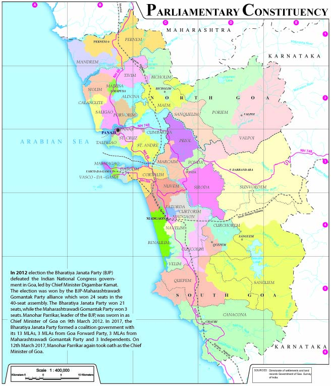
Parliamentary Constituency
State Atlas
wms
GIS service (1)
Metadata
2018
Land Use
State Atlas
wms
GIS service (1)
Metadata
2018
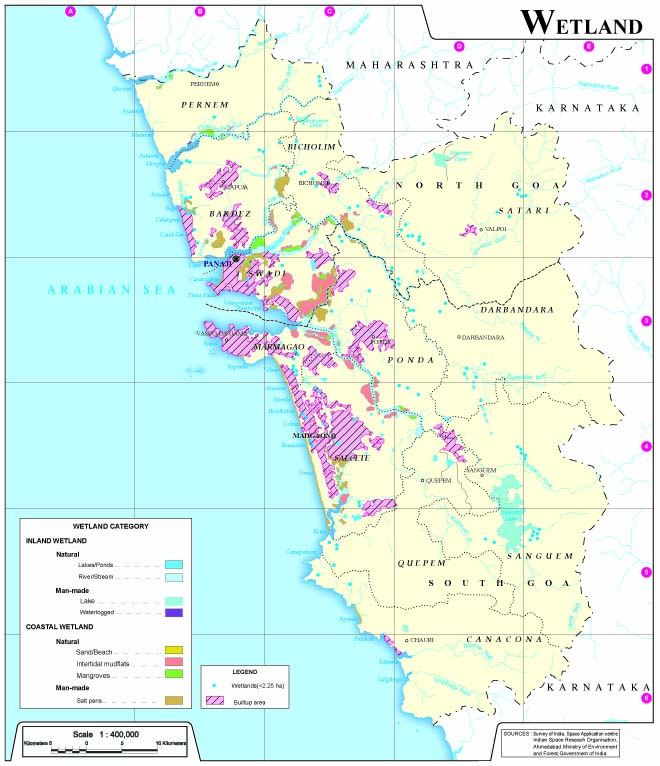
Wetland
State Atlas
wms
GIS service (1)
Metadata
2018
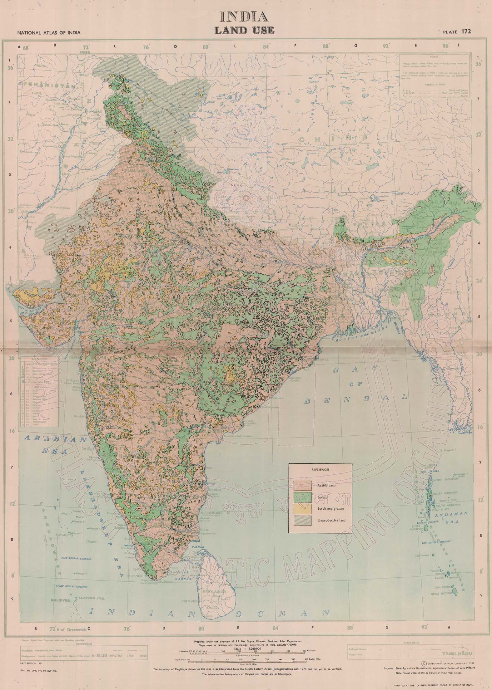
Land Use 1981
National Atlas
jpeg
wms
GIS service (1)
Metadata
1981
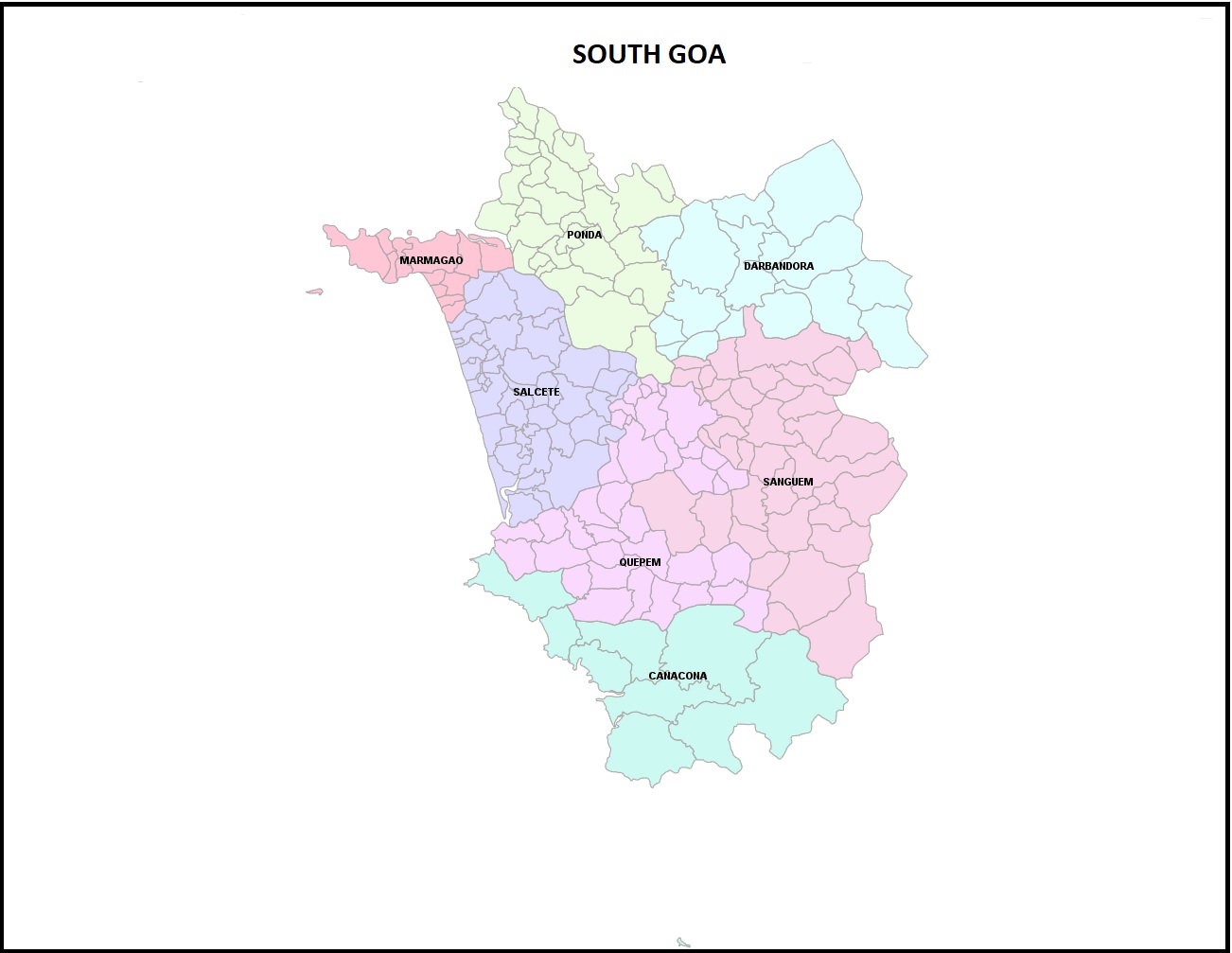
South Goa
District wise map
wms
GIS service (1)
Metadata
1970
Supaul
District wise map
wms
GIS service (1)
Metadata
1970
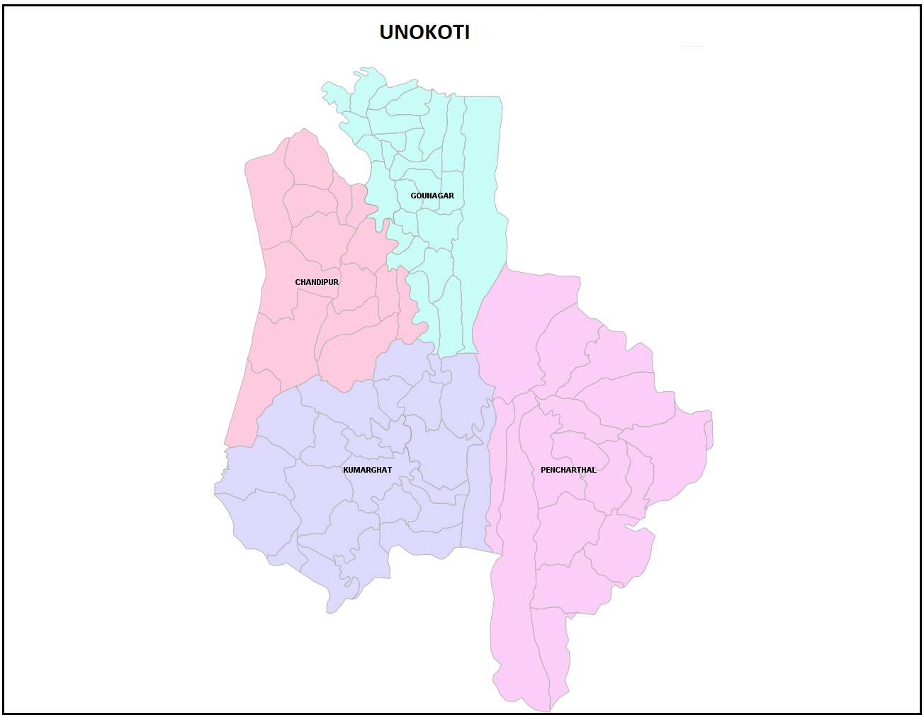
Unokoti
District wise map
wms
GIS service (1)
Metadata
1970
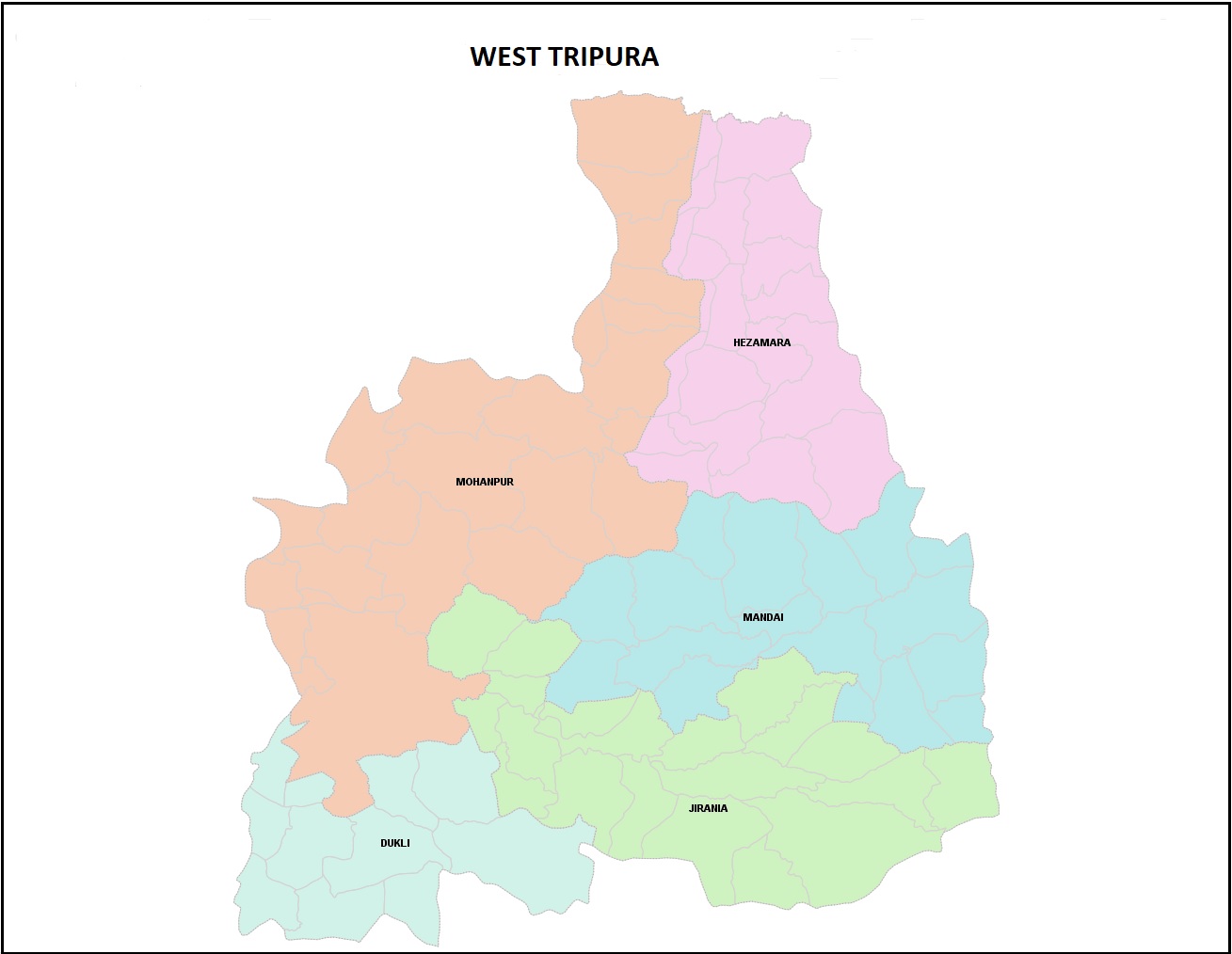
West Tripura
District wise map
wms
GIS service (1)
Metadata
1970
Sheohar
District wise map
wms
GIS service (1)
Metadata
1970
1
2
3
next ›
last »
Map Services/Atlas
District wise map (28)
Apply District wise map filter
National Atlas (1)
Apply National Atlas filter
National School Atlas (2)
Apply National School Atlas filter
State Atlas (4)
Apply State Atlas filter
Themes
Administrative and Political
Remove Administrative and Political filter
Landuse-Landcover
Remove Landuse-Landcover filter
-All (133)
Apply -All filter
Agriculture (15)
Apply Agriculture filter
Banking and Financial Services (1)
Apply Banking and Financial Services filter
Climate (6)
Apply Climate filter
Demography (13)
Apply Demography filter
District Planning Map Series (4)
Apply District Planning Map Series filter
Education (4)
Apply Education filter
Forest and Vegetation (1)
Apply Forest and Vegetation filter
Geology (5)
Apply Geology filter
Golden Map Services (12)
Apply Golden Map Services filter
Health (1)
Apply Health filter
History and Culture (3)
Apply History and Culture filter
Hydrology (2)
Apply Hydrology filter
Industries (6)
Apply Industries filter
Infrastructure, Utility and Services (2)
Apply Infrastructure, Utility and Services filter
Livestock, Poultry and Fisheries (2)
Apply Livestock, Poultry and Fisheries filter
Natural Hazards (1)
Apply Natural Hazards filter
Natural Resources (2)
Apply Natural Resources filter
Physiography and Geomorphology (3)
Apply Physiography and Geomorphology filter
Power and Energy Resources (1)
Apply Power and Energy Resources filter
Social Environs (1)
Apply Social Environs filter
Soil (3)
Apply Soil filter
Tourism (3)
Apply Tourism filter
Transport and Communication (8)
Apply Transport and Communication filter
Country
India (35)
Apply India filter
State
Bihar (11)
Apply Bihar filter
Goa (5)
Apply Goa filter
Kerala (1)
Apply Kerala filter
Madhya Pradesh (2)
Apply Madhya Pradesh filter
Tripura (7)
Apply Tripura filter
West Bengal (6)
Apply West Bengal filter
District
Alipurduar (1)
Apply Alipurduar filter
Alirajpur (1)
Apply Alirajpur filter
Anuppur (1)
Apply Anuppur filter
Araria (1)
Apply Araria filter
Bauxer (1)
Apply Bauxer filter
Birbhum (1)
Apply Birbhum filter
Dhalai (1)
Apply Dhalai filter
Gaya (1)
Apply Gaya filter
Gomoti (1)
Apply Gomoti filter
Gopalganj (1)
Apply Gopalganj filter
Kasaragod (1)
Apply Kasaragod filter
Khagaria (1)
Apply Khagaria filter
Khowai (1)
Apply Khowai filter
Maldah (1)
Apply Maldah filter
Murshidabad (1)
Apply Murshidabad filter
Muzaffarpur (1)
Apply Muzaffarpur filter
North & South Goa (1)
Apply North & South Goa filter
North Goa (1)
Apply North Goa filter
Paschim Medinipur (1)
Apply Paschim Medinipur filter
patna (1)
Apply patna filter
Saharsa (1)
Apply Saharsa filter
Saran (1)
Apply Saran filter
Sepahijala (1)
Apply Sepahijala filter
Sheohar (1)
Apply Sheohar filter
South Tripura (1)
Apply South Tripura filter
Supaul (1)
Apply Supaul filter
Unokoti (1)
Apply Unokoti filter
West_Tripura (1)
Apply West_Tripura filter
Scale
1: 14000000 (2)
Apply 1: 14000000 filter
1:1000000 (1)
Apply 1:1000000 filter
Data Type
Vector
Remove Vector filter
×
Meta-data
Geoportal
Description
×
Link for WFS.
http://geoportal.natmo.gov.in:1213/NSA_geology_publish_ws